The 50 Lost Waterways of Southwark
Turns out that colouring stuff in can be historically insightful.
Welcome to your Friday newsletter for paying subscribers, with a generous teaser for everyone else.
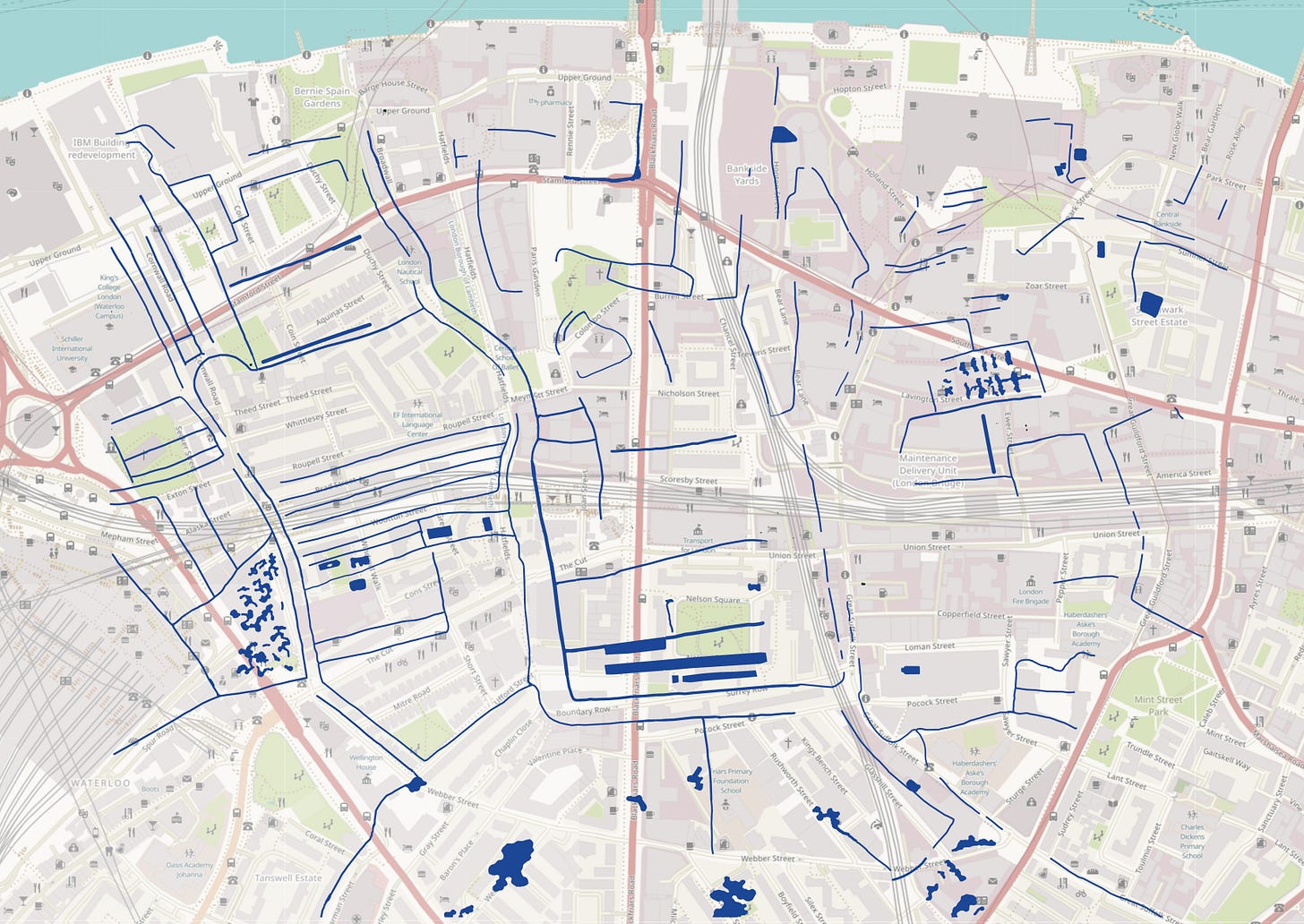
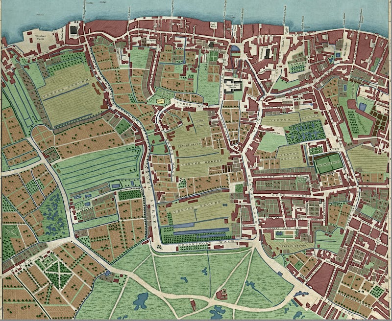
John Rocque’s 1746 map of London looks much brighter, now that I’ve coloured a section in, but there’s a bit more to it than meets the eye. In today’s short post, I’m going to look at what happens if we peel off all the rivers and streams and paste them onto a modern street map.
That’s for the main section. First, the History Radar of upcoming London history events.
History Radar
🗺️📍 JOHN ROCQUE: By chance, the subject of this week’s newsletters is also coming out to play at London Metropolitan Archives on 28 May. Hear a talk about Rocque and his work, and then marvel over original copies of his ‘Near 10 miles round’ map of the wider London area. Dang, wish I could make it.
👧🏾🧒🏻 KIDS GUIDED HISTORY TOUR: On 29 May, as a half-term treat, take the kids on a guided tour of the City aimed specially at 8-year-olds and over. Guide Lisa Honan reveals the history of the East India Company from its early trading in pepper and spices to ruling the whole of India. Come on a journey of greed, corruption, war, and Empire.
🔪🪦 BODYSNATCHERS: On 30 May, archaeologist and historian Robert Hartle is at the Old Operating Theatre in London Bridge, talking about the 'resurrectionists': bodysnatchers who stole corpses from churchyards and the like, to be used in medical research and teaching.
🎥🍿 LOST CINEMAS: Also on 30 May, get the lowdown on the lost cinemas of both east and west London in a London Salon evening at the Horse Hospital in Bloomsbury. Oral historian and broadcaster Alan Dein covers east London, from the early years of cheap and cheerful picture houses to the likes of The Troxy, a magnificent 3000-plus seater built in the 1930s. He's followed by cinema historian Nigel Smith discussing the lost cinemas of west London, particularly the Acton area, which once boasted five local picture houses.
🕍🌛 SOANE LATE: On 31 May, see Sir John Soane's Museum illuminated by candlelight at a Soane Late. The event offers a closer look at the current Fanciful Figures exhibition, about the small figures seen in architectural drawings. Explore the house and exhibition, with experts on hand to offer further insight, and enjoy a glass of wine in the Library-Dining Room (included in your ticket).
✈🎶 D-DAY WEEKEND: Next weekend (1-2 June), the RAF Museum in Hendon marks the 80th anniversary of D-Day with two days of family-friendly events including live music, swing dancing, glider making, and a programme of talks.
⛪️🪦 LONDON FESTIVAL OF ARCHITECTURE: The celebration of architecture and 'city-making', the London Festival of Architecture celebrates its 20th anniversary this year. It begins on 1 June, and the programme includes tours of historic spaces such as the Old Palace in Bromley, Crystal Palace Subway, and some of London's suburban cemeteries.
💧🚀 SOUTH LONDON HISTORY: The Woodfield Pavilion in Tooting Bec Common has a number of talks and walks on 1 June as part of its heritage day. Catch talks on the local asylum (11am), V1 and V2 strikes on south London (noon), lost rivers of south London (1pm), a walk in Balham (2pm) and Streatham in the past (3pm).
And speaking of lost rivers of south London…
The 50 Lost Waterways of Southwark
I hope you enjoyed the colourised Rocque map of 1746 in the previous newsletter. It’s so rich in detail that I thought I’d spread the commentary over two newsletters.
When I coloured in the John Rocque map, I didn’t just colour it, like you would with pens or crayons. I purposely separated each feature out onto a different Photoshop layer. One layer contains buildings, another trees, another cultivated fields, and so on. This allows me to isolate one particular layer from all the rest.
So, for example, we can take Southwark/Lambeth:
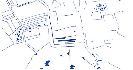
And we can isolate all the water, thus:
And then… this is the delicious part… we can superimpose these 18th century streams, pools and drainage ditches over a modern street map of the area. Huzzah!

The first thing that leaps, nay, squirts out of the page is just how much water there was in south London. It’s more sodden than a Rishi Sunak press conference. This surface water is hardly noticeable on the original John Rocque map. It’s camouflaged among all the other grey-shaded detail. But colour it in, and paste it onto a modern map, and we have quite the splash. The “50 Lost Waterways of Southwark,” I’m calling them, with only a trickle of hyperbole.


