


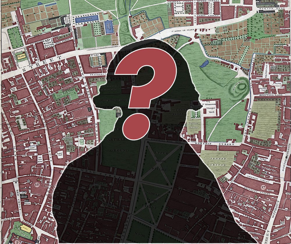
Who Was This John Rocque Fellow Anyway?
The man behind the maps.

Welcome to Londonist: Time Machine, the newsletter for London history.
I’ve been colouring in his maps for a year now, but I’ve not really written much about John Rocque the man. Who was this 18th century cartographer? How did he produce the greatest city map of his era? And how do you pronounce Rocque, anyway?
That’s for the main section. First, news about an upcoming site visit and the History Radar…
Site visit
I’m delighted to announce another upcoming site visit for paying subscribers. We’ve been offered a tour of the wonderful Brunel Museum in Rotherhithe on 1 May 2025. As I’m sure most readers will know, the museum tells the story of the first tunnel under a major river anywhere in the world, which today carries the Windrush line beneath the Thames. Completed in 1843, it was the handiwork of father-and-son team Marc and Isambard Brunel.
The visit will include a short introductory talk, a look around the museum’s engine house exhibition, and then a chance to descend into the Grade II*-listed tunnel shaft. This will be an evening visit, and I’m told there will be a paid bar open as well. Afterwards, those who want to stick around can join me for a drink or two in one of the nearby riverside pubs.
This is a free tour (though museum donations would be appreciated), open to paying subscribers of Londonist: Time Machine and their plus-ones. To reserve a place, just email me on matt@londonist.com. (Venue accessibility notes here.)
History Radar
Upcoming events for people interested in London history.
💧 HAMPSTEAD RAINSTORM: Fifty years ago, Hampstead Heath experienced a highly localised deluge. On 24 March, Lester Hillman, who witnessed the storm in August 1975, gives a talk about the experience at Guildhall Library.
👩🍼 CALL THE MIDWIFE: On 24 March, visit the real-life locations of Call The Midwife on a guided walk, beginning at All Saints DLR station and taking in sights including the real Nonnatus House, the streets around which the midwives cycled, and the remains of East India Docks. It's a Bring Your Baby walk, aimed at parents and carers with babies, with feeding and changing breaks built in.
🏛️ TEMPLE BAR: For those who were unable to make it on our recent site visit to Temple Bar, here’s another chance. On 27 March, join excellent tour guide Jonathan Wober for a two-hour tour of the area around St Paul’s, culminating in access to the 350-year-old Wren structure. Whet your appetite by reading my brief history of Temple Bar.
🧑🏻🚒 THAMES ACTION: This month’s London Salon (27 March) still has tickets at time of writing (rare… it normally sells out). The theme this month is “Fighting Fire and Felony on the Thames” with speakers Billy Reading and Robert Jeffries (whom some readers will remember fondly from our tour of the Thames River Police Museum). These Salons are fab, and worth keeping an eye on. I’m doing one in June.
🏴☠️ PIRATES: I’m not sure how “Londony” it’ll be, but the National Maritime Museum in Greenwich opens an exhibition all about pirates on 29 March, challenging their depiction as swashbuckling adventurers in search of buried booty. Real-life pirates feature, as well as fictional characters from books, TV and film, and Orlando Bloom's Pirates of the Caribbean costume is among the objects on display.
🍺 SOHEMIANS Beyond the coming week, I’d like to flag up the Sohemian Society, who put on regular talks about the history, culture and subcultures of Soho. Their talks tend to sell out very fast, though they’ll soon be moving to a bigger venue. Upcoming topics include a chat with prolific armed-robber and Kray associate Ronnie Field, scandal in Dolphin Square (a bit beyond Soho, but with links), and the life and work of George Orwell. Take a look at the programme, and book early to get a seat.
Who Was This John Rocque Fellow Anyway?
He created the most enticing, compelling, “Oooo”-inducing London map of all time (in my humble opinion). But who was John Rocque, the 18th century cartographer whose handiwork I keep colouring in?
Rocque’s early biography is a compote of uncertainty. We don’t know what he looked like, where exactly he was born (possibly somewhere in France), when exactly he was born, or the names or trades of his parents. We don’t even know, for sure, how he pronounced his name. His probable French origin would suggest something like “Roke”, and this is how I usually hear it said. Then again, he anglicised his forename from Jean to John, so it’s possible he pulled a similar trick with his surname to favour a “Rock” pronunciation. That’s my pet theory, and I’m sticking to it, if only because it allows for puns in subheadings.
Between a Rocque and a Hard Place
Whatever his origins, they’re likely to have been traumatic. Rocque was born into a French Huguenot family somewhere around the turn of the 18th century — 1704 is often given as the date, corroborated by his supposed age at death.
Now, the Huguenots were not exactly popular in France. This Protestant group had long been at odds with the Catholic majority. In 1685, King Louis XIV removed their legal protection, and the Huguenots found themselves under increasing persecution from the authorities. Protestantism was outlawed. The Huguenots could either convert, or flee for their lives.
The Rocque family were in the latter cohort. It’s not clear when they made their move. John Rocque is usually described as French-born, which I find a little hard to square with a birth date around 1704, by which time there were few Huguenots left in France.
Possibly he was born in Geneva. Much later documentation shows that two of Rocque’s brothers (Bartholomew and Claude) had lived in that city as young men, which suggests John might also have been there. However, circumstantial evidence also places the family in England as early as 1709, when a John Rocque is listed on a naturalisation ‘oath roll’. This may be the youngster, or perhaps his father, though we can’t rule out an unrelated Mr Rocque.
Rocque gardens
For 20 years we learn nothing more. Where Rocque was living, his place of education, his apprenticeship or training — all are lost to history. The first reliable Rocquian record comes from 1728, when ‘Jean and Martha Rocque’ are noted as godparents to a Jean Vivares, the son of a French engraver. We can be confident this is ‘our Jean’, because the adult Vivares would later be named as one of Rocque’s engravers.
John’s first known address is in Great Windmill Street in Soho. This was a popular location for Huguenot immigrants. A wonderful reminder of this history can be seen on a door frieze in Soho Square, which depicts Huguenot immigrants being welcomed into the country.
Rocque lived in Soho from at least 1736, and this is also the period from which his first handiwork survives. All of his earliest maps show plans of gardens. The earliest, of 1734, covered land that is now part of Kew Gardens. Other commissions included Wrest Park in Bedfordshire, Claremont in Esher, and Chiswick House in what is now west London. He even worked on Windsor Park in 1738. He worked closely on these maps with a brother called Bartholomew Rocque, who lived in Walham Green near Fulham and was noted as “a great artist in agriculture”.

These maps, funded by the wealthy landowners, were the perfect training ground for Rocque. He was able to develop techniques of surveying and drafting that would later be of great use to his city maps.
We built this city on Rocque and his rolls
And so to the London map. Rocque began work on his magnum opus as early as 1737. The task was formidable. Maps of London had existed since at least 1550s, but these were either poorly surveyed, or lacking in detail, or both. One of the finest, Ogilby and Morgan’s chart of 1676, strays little beyond the City walls, and names only the major roads. Rocque envisioned something both wider and deeper; a map that would extend beyond the built up area, and that might contain the names of every mean alley.
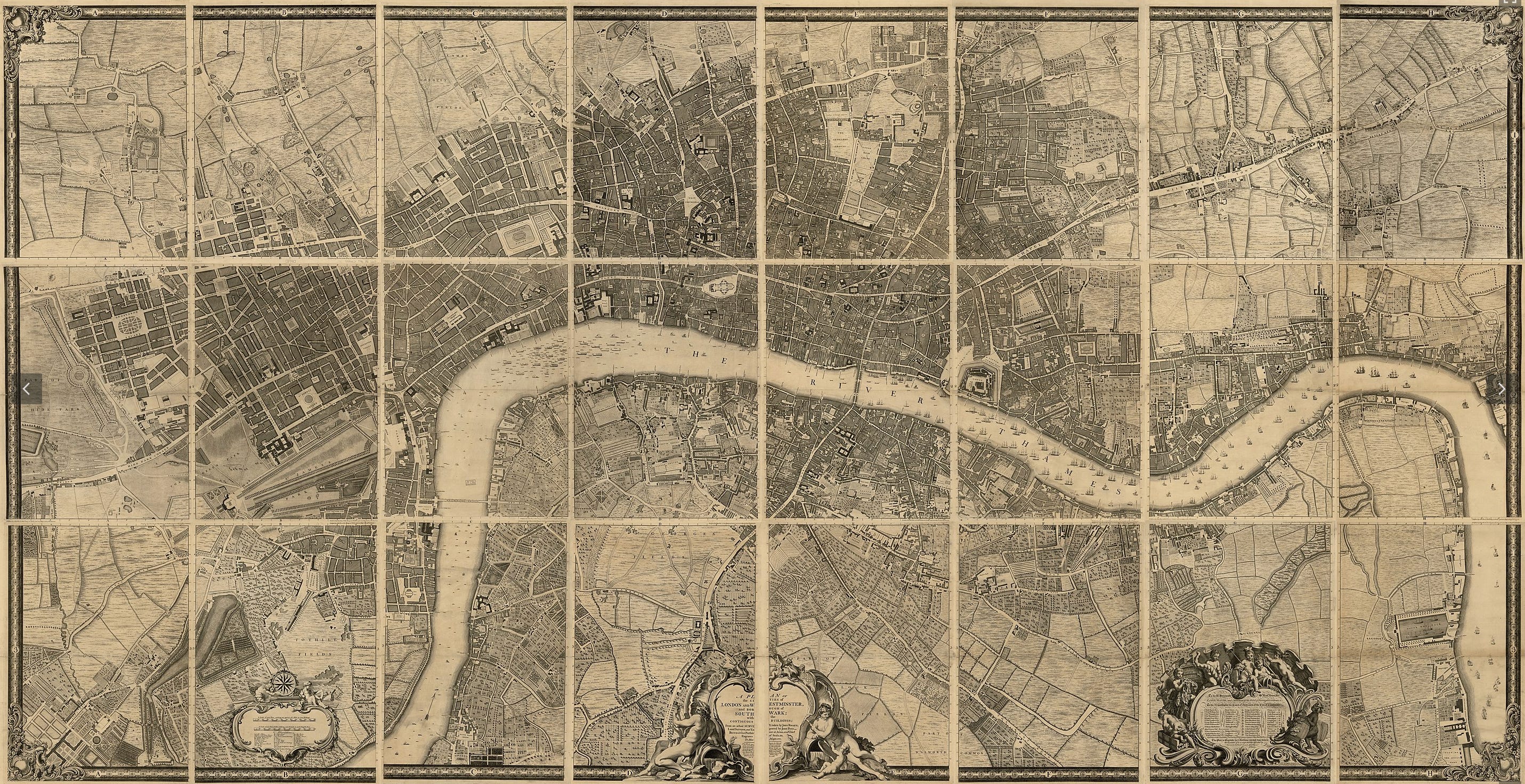
This ambitious work, undertaken in collaboration with the engraver John Pine, took seven years to complete. The first challenge was to raise enough money to conduct the survey. Happily, Rocque and Pine were able to secure the support of the Lord Mayor, and thereby gained subscriptions from hundreds of wealthy individuals and companies.
Rocque then turned from raising capital to measuring the capital. His surveyors scurried to “The Tops of Steeples, Towers, and other Places” to get the best trigonometric sight-lines. Distances were independently measured by laying down chains. These two techniques could then be compared to ensure accuracy.
The most excellent Professor Tim Hitchcock — creator of Locating London’s Past, which uses Rocque’s map to display demographic information — gave me an intriguing insight into the accuracy of this method. He tells me that Rocque’s map can be overlaid almost perfectly onto a modern street map for central areas of London. As we move out towards Finsbury or Lambeth or Marylebone, the overlay is increasingly “off”. The reason is simple. These outer regions were still mostly fields in Rocque’s time, and his surveyors had few high points from which to triangulate. Hence, the accuracy is diminished.
It is still a remarkable achievement. And the map’s glory comes not just from its accurate surveying but also for the attention given to street names. Rocque and co. seem to have chatted to the locals on every street corner. The following quote comes from an index to the map, published shortly after the main event:
“Every Part was not only actually surveyed, but the Name of each Spot was collected on the very Place, and not taken from any former Account. By this Means we have obviated all the Difficulties that might have arisen with Regard to Spelling or Pronunciation, and reduced the whole to the Standard of Custom, which is the only certain Rule on such Occations. But at the same Time these Names were compared with those in former Accounts, and where any great Disagreement was found, Enquiry was made into the Cause of it, and the Truth cleared up with as much Exactness as Possible.”
After the plan was finished, it was “Submitted to the Inspection of all the Curious”. Any nitpicks were looked into, and amended if necessary. In this way, both the content (i.e. the street names) and the editing had been crowdsourced. It would be hyperbolic to suggest that this was the OpenStreetMap of its day, but the parallels are delicious to contemplate. As a final check on accuracy, men were sent out with copies of the map to every quarter, to make a close comparison of the printed plan and the street reality.
The 24-panel masterpiece was finally published in 1746. It was an immense achievement, taking London’s street-map to a whole new level of precision. Breadth, too. The completed chart represents an area spanning six miles from east to west, and three miles north to south, and encompassing some 11,500 acres. The original panels, when placed alongside one another, would spread some 13 feet wide by seven deep (4 metres by 2 metres). The scale is a 200 feet to the inch.
The map-makers were confident that the map would have longevity. A note to the index spells out as much: